FCC Broadband Funding Map Tracks Federal Awards
NRTC Communications
|
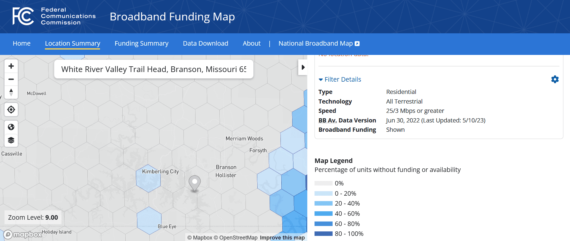
The FCC has released a Broadband Funding Map on its website. The new map is separate from the earlier introduced and work-in-progress National Broadband Map, which shows where broadband service is already deployed and available. The funding map shows where government agencies have awarded broadband funds and specific locations are eligible for funding.
Map data includes the FCC’s own Rural Digital Opportunity Fund and ConnectAmerica Fund 2 programs along with information from broadband programs administered by the Rural Utilities Service, the U.S. Treasury Department and the National Telecommunications and Information Administration.
“The Broadband Funding Map allows users to identify, search, and filter federal funding programs by the Internet Service Provider receiving funding, the duration timeline, the number of locations included in the project, and the download and upload speeds,” according to an FCC Public Notice. The Commission plans to update the map regularly when receiving additional data from the various agencies.
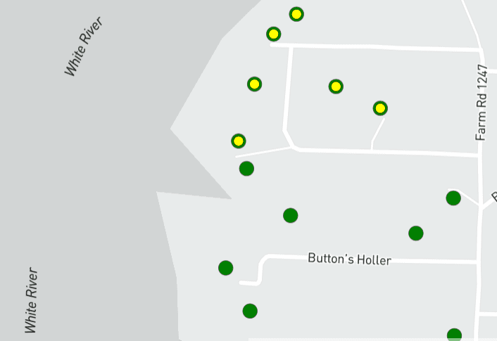
Users entering an address will see a street-level map indicating individual locations’ current funding status. For example, the map pictured below is of locations along the White River in Missouri, where NRTC member White River Valley Electric Cooperative (WRVEC) recently won $47 million in broadband funding. Green dots indicate locations where broadband coverage exists, and there is no available broadband funding. Yellow dots inside dark circles indicate coverage and funding are both available. On other maps, yellow dots indicate no coverage, but funding is available.
Other functions on the map site allow users to download more precise data with more detailed location information and the specific programs that are funding those areas.
By expanding the map to the census block level, users can see broadband coverage and funding availability over wider regions as of June 30, 2022. The view of WRVEC’s Branson, MO, region (pictured at the top of the page) shows several gray regions indicating zero-percent coverage, and light blue regions indicating partial coverage.
NRTC members researching funding availability could use the new FCC map along with NRTC’s Funding Opportunity Map to pinpoint possible funding locations and the programs that could support them.